If you live in Tallahassee, or have visited Florida’s Capital, you are likely familiar with a Tallahassee landmark – Mission San Luis, or San Luis de Talimali as it was named by the Spanish. It was a 17th Century Spanish Mission located on the present-day corner of Ocala Road and West Tennessee Street. From 1656-1704 it was the western capital of La Florida, and housed approximately 1400 Apalachee, including the chief, a resident Franciscan friar, a Spanish military garrison, the soldiers’ families, and other civilians (McEwan 1993).
Previous archaeological excavations focused on determining the site layout and uncovering the larger structures, especially the Apalachee Council House and the Mission Church. A Spanish-style domestic structure and associated features were also investigated. The ten field seasons (not contiguous) or archaeological investigations at San Luis have yielded important information about the Spanish presence in the capital. Likewise, the excavations of the Apalachee Council House have given us insight into this important structure that centered indigenous public and ceremonial life. With the information gained from archaeological excavations and documentary resources as our foundation, we propose to explore the community of Apalachees and Spaniards who lived, worked, and died at San Luis.
*Inside of reconstructed Apalachee Council House at Mission San Luis. Photo taken by author, January 2017.
What is the Southeastern U.S. Ancient Turkey Project?
Traditionally, turkeys found at archaeological sites in the Southeast are thought to be the remains of meals served and eaten long ago, with the birds having been killed in the wild by ancient hunters. We agree that many of these turkey bones are probably refuse left from ancient meals. However, based on our data and studies from other parts of the Americas, we suspect that the people at Fewkes (and other late prehistoric sites in the Southeastern US) had a relationship with turkeys that was more complex than we previously thought. It is highly likely that people were managing wild turkey populations, possibly to the point these turkeys were domesticated, or at least on the brink of it.
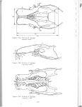
Here is the abstract from our soon to be published paper in Journal of Archaeological Science: Reports [Archaeological Correlates of Population Management of the Eastern Wild Turkey (Meleagris gallopavo silvestris) with a Case Study from the American South, by Tanya M. Peres and Kelly L. Ledford, Florida State University]
The wild turkey (Meleagris gallopavo) was an important food resource to Precolumbian Native Americans; however, little attention has been given to the subject of turkey husbandry, or use in the American Southeast. We thus present demographic turkey data from the Mississippian Period Fewkes site in Tennessee, ethnographic and ethnohistoric information on Southeastern Native Americans, and material culture data from Tennessee and Alabama to explore the use and potential management of eastern wild turkeys (M. gallopavo silvestris). The osteometric data from the Fewkes site indicates that both male and female adult turkeys are represented in the faunal assemblage, with males being present in equal or greater numbers than females. It appears that the female specimens were not taken during the egg-laying period. The results can be interpreted as either the result of humans managing local turkey populations as sources of both meat and feathers, or occasional selective hunting of large adult males.
Here is a blog post Dr. Peres an Kelly Ledford (FSU Anthropology MSc Student) wrote about this project for the “30 Days of Tennessee Archaeology” blogfest.
Southeastern U.S. Ancient Turkey Project in the News!
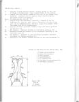
We are community sourcing zoorchaeological, osteometric, and metadata on the archaeological occurrences of turkey in the Southeastern U. S. If you have turkey in a collection you are working, would you be willing to take a few extra minutes to measure all measurable elements and/or partial elements, and enter corresponding data into our Google Form? Your contribution to this project will be acknowledged!
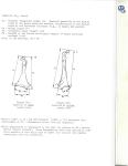
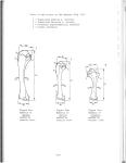
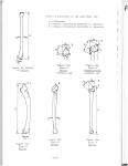
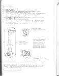
What parts can be measured and how does one do it?
-Measurements are standardized. You can look at these relevant pages from
– post by Tristan Harrenstein, Florida Public Archaeology Network
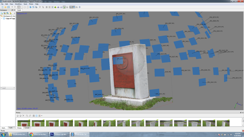
In the last few years, archaeologists have been getting excited by the potential for recent advances in something called photogrammetry. This technology takes a collection of photographs of an object, plugs them into a program (Agisoft PhotoScan in this case), and builds a digital 3D model.
This is exciting! Photogrammetry is already useful for research and education, but it is also changing the way we record archaeological sites. Dr. Kotaro Yamafune (Research Associate in Nautical Archaeology at Texas A&M University) has an impressive body of work using this technology to record underwater shipwrecks. After five days of photographing, he was able to generate highly accurate and easily manipulated maps that would normally take years and many divers. The use of photogrammetry saved money and people hours, without sacrificing accuracy or data.
Which brings us to the purpose for this blog post. Since there has been so much success modeling underwater archaeological sites, what potential does photogrammetry have for sites on land? Might this technology someday replace hand drawn maps? To test this, Barbara Clark and I visited Florida State University’s archaeological field school this summer and modeled one of their excavated units.
Might photogrammetry make mapping a thing of the past? (Image courtesy of the University of West Florida’s Department of Anthropology)
One limitation of photogrammetry software is that it needs identifiable features so that it can figure out where each picture was taken in relation to the others. I was concerned that the unit walls would look too much alike for the program to align the pictures properly. As a result, we made two models of the same unit. The first set of photos were of the plain unit walls while the second set included some photo board symbols pushed into the sides to provide points of reference for the program.
Each blue square represents the location of a photo that makes up this model. Fortunately, Photoscan calculates this for us.
The Results
To be clear, this experiment was not supposed to be definitive. The goal was to get some idea of how much potential there currently is for photogrammetry as a tool for recording terrestrial archaeological excavations and to better understand what equipment we would need. That being said, these models turned out far better than I had expected, with very little difference in quality between the two tests.
See an example of the terrestrial photogrammetry we did on one excavation unit at the FSU Anthropology’s 2016 Archaeological Field School HERE!
*Please note, these examples are using just 500k faces each. A much higher resolution of 25 million faces is possible, but not many computers can currently handle this.
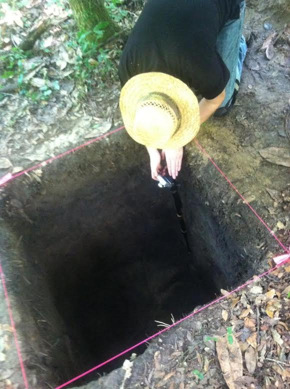
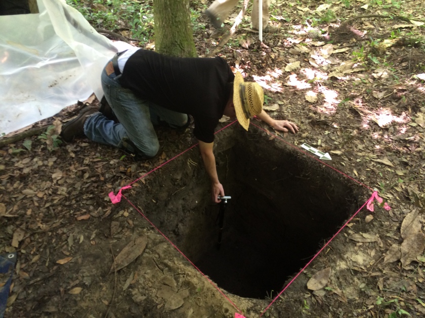
As far as the equipment goes, we need better photographing methods. Even with the monopod, taking pictures of a unit this deep was difficult and uncomfortable. I spent a lot of time with my head in the unit, or standing at awkward angles inside the unit, trying to hold still for the camera while yellow flies gleefully seized upon the opportunity to grab a bite.
On the upside, the solution to this is relatively simple. All we would need is a pvc pole, a camera mount for bicycle handlebars, and a remote for our camera. This would take a few test shots to make sure the angle was correct, then the rest would be faster and much more comfortable. Throw in a white tent to help diffuse the light evenly and we should be in good shape.
But is this worth pursuing further? We certainly do not have the same limitations on land that our underwater peers do, and photogrammetry cannot replace hand-drawn profiles of unit walls any more than pictures can (due to a tendency to distort colors). Does this mean that photogrammetry has no current value for terrestrial archaeology?
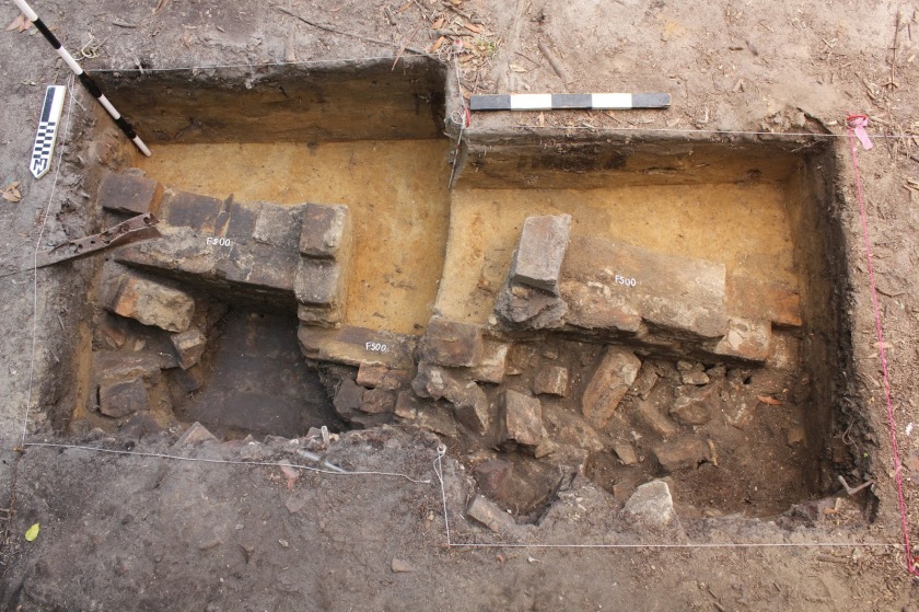
Absolutely not. There are a lot of ways this technology could be invaluable right now. Do you have an artifact that you cannot take back to the lab with you? A few minutes of photographing means you can examine it later at your leisure. This also has excellent applications for complex features that do not just rely upon soil changes, such as brick structures. Photogrammetry models provide a sense of depth that even the most diligent hand-drawn maps or pictures cannot capture very well.
Mapping a feature like this one on 2D graph paper is very challenging and time consuming. Photogrammetry is already an improvement for a situation like this. (Image Courtesy of the University of West Florida’s Department of Anthropology.)
Mapping a feature like this one on 2D graph paper is very challenging and time consuming. Photogrammetry is already an improvement for a situation like this.
In a nutshell, photogrammetry currently has some excellent, if situational, uses in terrestrial archaeology. Perhaps this will revolutionize the way we record sites, or perhaps it will just remain a very specific tool for a specific job. However, technology is advancing quickly and I would not be surprised if photogrammetry, scanning, or just tablets make hand-drawn profiles obsolete someday. We will need further testing to fully understand the potential of photogrammetry, but now is the time to begin.
Tristan Harrenstein is trained as an archaeologist and has a passion for outreach and education. This is fortunate as he is also an employee of the Florida Public Archaeology Network, an organization dedicated to promoting the preservation and appreciation of our archaeological resources. He shares a blog space with his boss (Barbara Clark) and you can read more blog posts on other archaeology related subjects that tickle our fancy here.
If you recall from a few weeks ago, FSU Office of University Communications spent a few hours in the field with us to document our work and uniqueness of the archaeological field school as a hands-on learning opportunity for FSU students. Staff of the FSU Communications office – Nora Bertolaet, Digital Content Producer, Ryan Ruditz, Videographer and Editor, and their skilled crew produced a fabulous piece that we are all proud of.
On Thursday we hosted a number of visitors to our field site, in addition to our regularly scheduled volunteers and our partners at SEAC. Archaeologists with the Florida Public Archaeology Network came out to see our work and to experiment with photogrammetry.
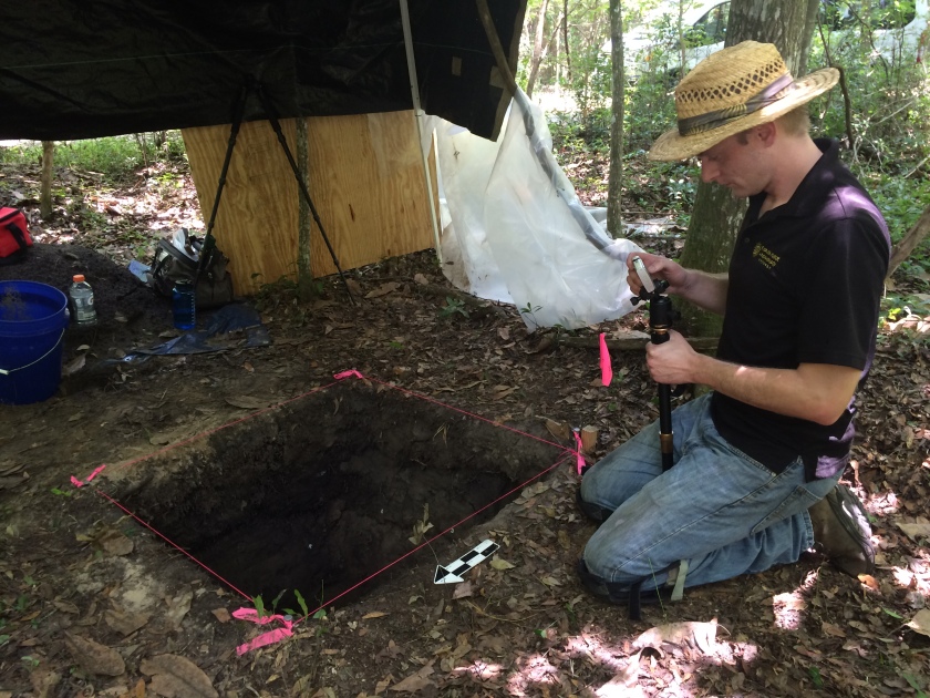
FPAN Archaeologist, Tristan Harrenstein, takes shots of an excavated unit.Tristan (FPAN) checking the pictures and how much life is left in the battery. You can see the plywood and plastic in the background that was put up so there unit would be completely in shade. The dappled shade/sun of the natural tree cover does not make for good archaeology photos.
We also had a visit by a retired soil scientist that has worked all over but is especially knowledgable about the soils in our area. We need to figure out if some of the sands we are encountering in our excavations are naturally occurring or if the people that lived here 1200-1400 years ago brought them to this specific location. If it is the latter, we then get to puzzle over (and hopefully answer) – Why? Next week we will take sediment samples and cores of various parts of the site for further analysis.
We were very excited to host staff from the FSU University Communications office. They brought out a number of digital and video cameras to capture our work. It was wonderful to share our passion for archaeology and the excitement for what we are learning about the last people to live here is palpable. Nora Bertolaet, Ryan Ruditz, and their team were wonderful to work with and asked really great questions! We can’t wait to see the finished product (which we will post here of course)!
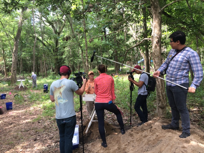
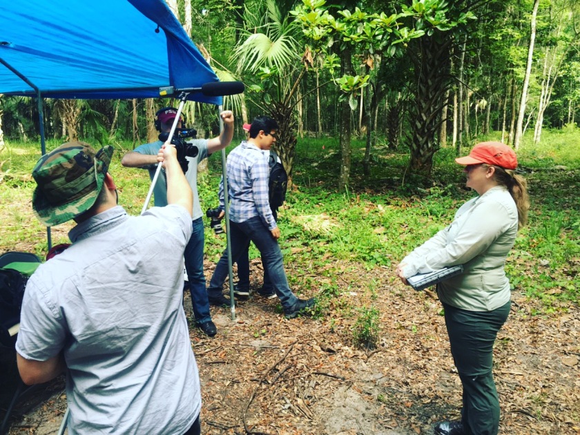
FSU University Communications staff learn about some of the tools and technologies used by people at this (and neighboring) sites over a thousand years ago. (They are interviewing Thadra Stanton, FSU Anthropology Alumna and current staff with SEAC.)FSU University Communications videographer and assistants interview Dr. Tanya Peres about our work at the site and the FSU archaeological field school course.
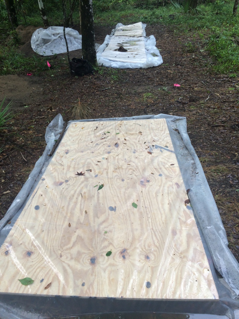
We were anxious as we returned to the site this morning, unsure of the extent of any damage to our excavations from Tropical Storm Colin. On Friday of last week we took extra precautions when we covered the excavation units in anticipation of three days of rain – but that was before the rain turned into TS Colin! We are so glad we bought plywood and made extra efforts – they paid off!
Several of our excavation units covered with plywood and plastic. They worked!
In several of our units near the swamp (and on a downslope) we were not so lucky. We had to create a bucket brigade to get the nearly 40 cm of water out of the deepest unit!
This slideshow requires JavaScript.
Fortunately for us, we are nearly finished excavating the units that were inundated. This means we can leave them to dry out over the next few days and finish our work in there later this week.
So, the crews that were in those units were sent to join the rest of the group and we opened three more excavation units to extend our view into the site. We still have lots of work to do as we uncover features and try to figure out the puzzle of the past, but we are having a great time! Thanks for reading!
If you have watched or listened to the news, you know that Tropical Storm Colin is crossing the state of Florida as we write this. The rains from TS Colin arrived in Tallahassee overnight and continued throughout the day. This meant no fieldwork for us. Instead we spent the morning in the lab at the FSU Department of Anthropology washing, sorting, and re-bagging dry artifacts. These are important first steps in artifact analysis.
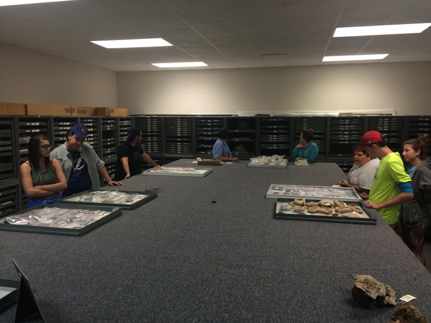
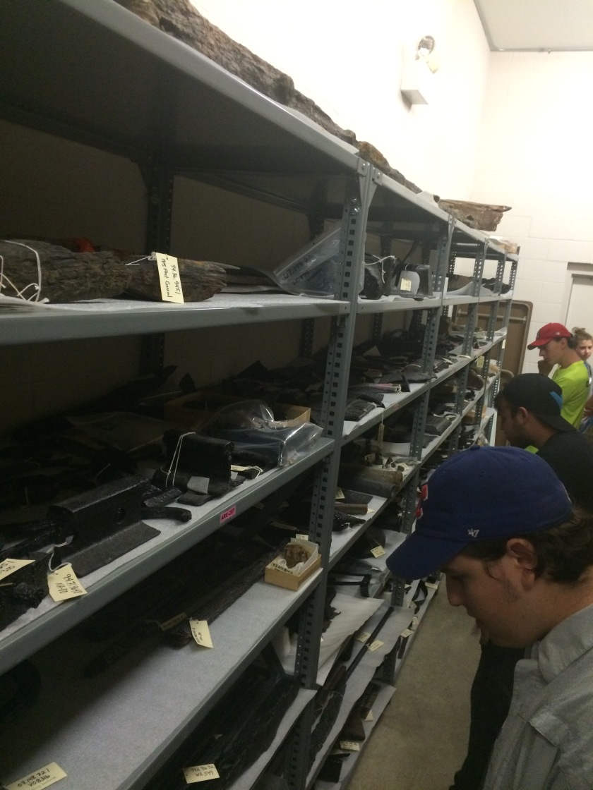
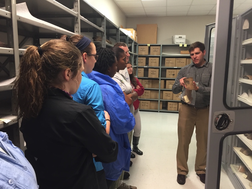
After lunch we were able to take a tour of the State Archaeological Collections curated by the Bureau of Archaeological Research, Florida Division of Historical Resources (thanks to Haley Messer for arranging and the staff of BAR for taking time out of their busy day to show us around).
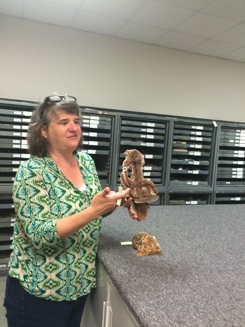
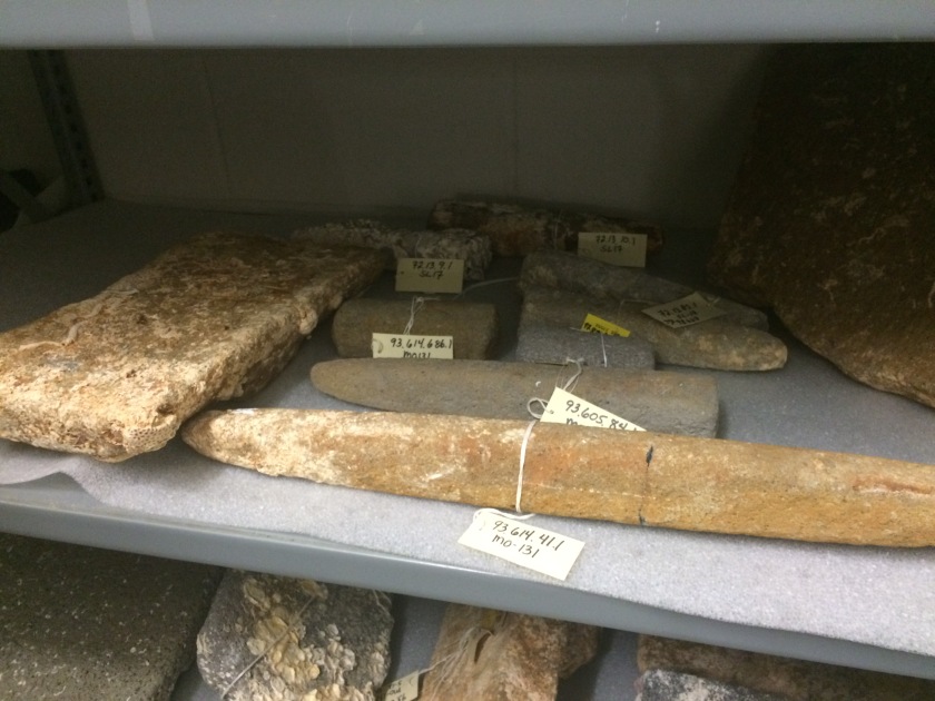
FSU Archaeological Field School students look at one room of curated artifacts. BAR Senior Archaeologist, Marie Prentice, explains how this sword hilt was conserved and cast.The FSU Archaeological Field School students were overwhelmed by the material culture curated at BAR.Manos and metates of Mexican origin are curated here. These come from various Colonial Period Spanish shipwrecks in Florida waters. They were meant to be unloaded and either sold or gifted to family, friends, and supporters in Spain.Dr. Dan Seinfeld, Archaeology Collections and Conservation Supervisor, describes how a particular artifact may have been used.
We are headed out to the site tomorrow, rain or shine, to check on the status of our excavation units and continue where we left off last week. Stay tuned!
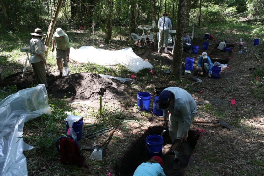
Today we continued excavating our units (there are 13 total units being excavated). Each unit is along the same coordinate line so that we can eventually create one continuous trench.
Our units are in a line running south to north, though not always touching each other. This allows us to see a cross-section of the site on the long axis.
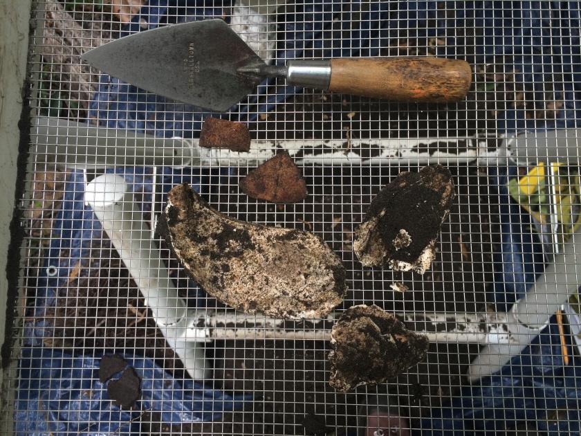
Many of the excavation units thus far have contained pottery sherds and lithics while others have contained shells and bones.
Fragments of turtle shell, oyster shells, and pottery are examples of the types of remains we find that give us clues about ancient life in this part of Florida’s Gulf Coast.
The discovery of these artifacts allows us to map out the site and see how far the plaza, the place where people once used for daily activities, extends and where the shell midden ring, where they discarded their waste, begins. In addition to the artifacts we are discovering in each unit, the color changes in the soils can also tell us important information about the site. For instance, a few of the units have contained a light yellowish colored soil that is distinct from the usual light brown colored soil.
The tools on the left side of the picture are some of the things we need in addition to our more traditional shovels and trowels.
The units with the light yellow soil have been marked as a part of the plaza area. These particular features are also starting to appear in adjacent units as well. The more units we open up the more we can tell about where the plaza ends and where the outer shell midden begins. This information will help us map and better visualize the perimeters of the site.
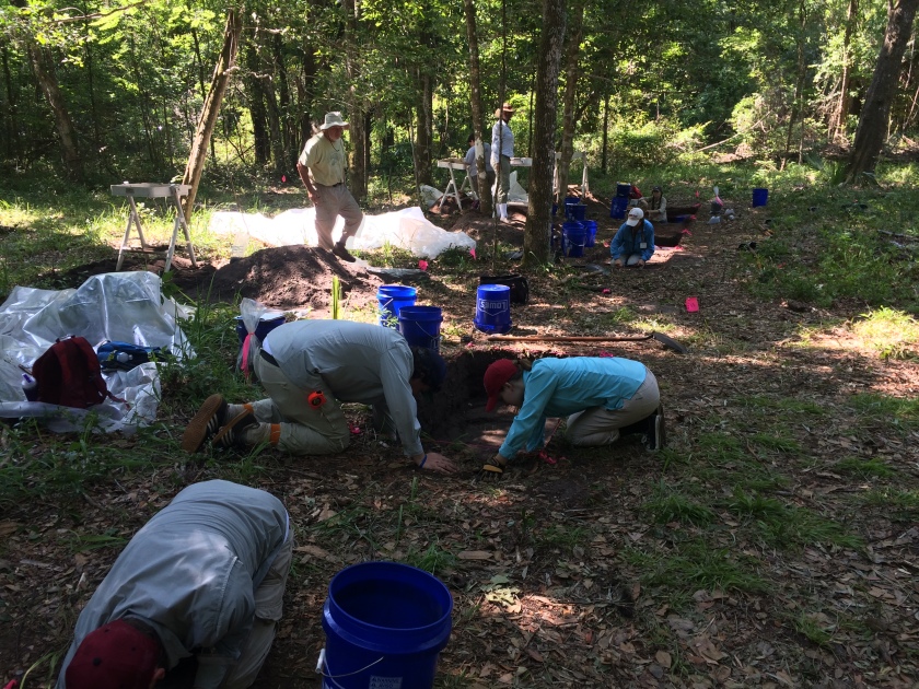
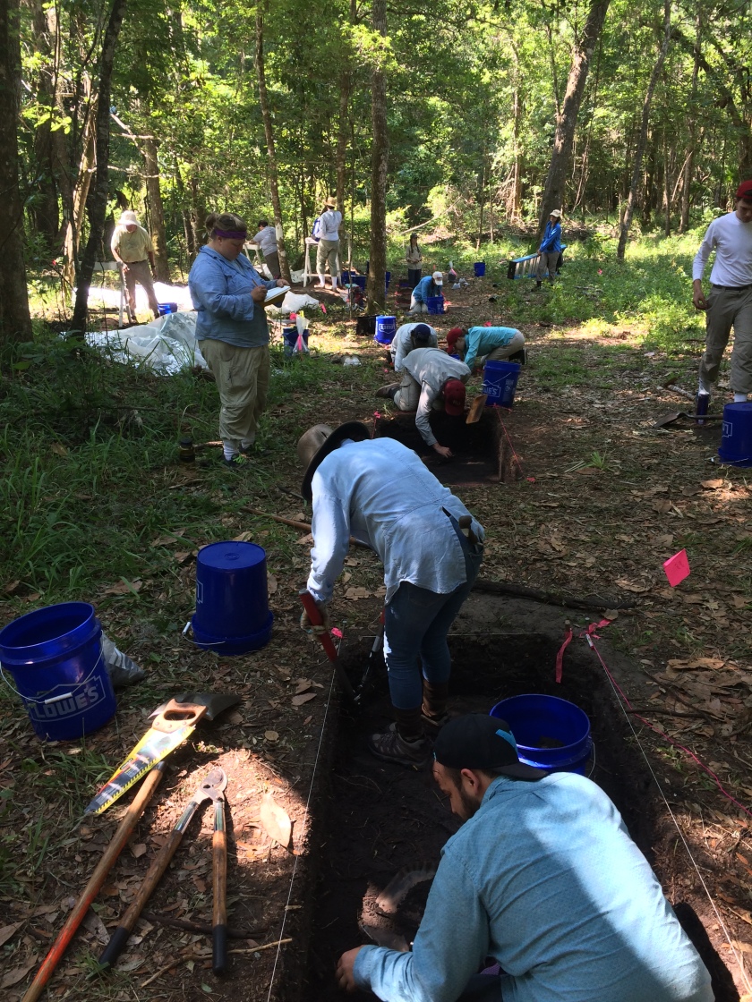
Thursday was an incredibly productive day in the field. We have 13 units in active or suspended excavation (meaning we stopped excavation because we identified features and will return to them during the last week). The excavation units are where the art of excavation actually takes place.
Units under active excavation by FSU Archaeological Field School students and volunteers with the National Park Service and Friends of the St Marks National Wildlife Refuge.
Today, all of the groups were schnitting (shovel skimming), troweling, measuring elevations/depths of units, plotting artifacts and features in situ, and screening through soil searching for the artifacts excavated from the units. Schnitting is a very important skill learned in field school where the excavator gently shaves off centimeters of soil, so as not too dig too deep. This allows us to identify features as they first appear. Once a layer of excavation is finished the trowels are used to create straight walls and sharp corners and to produce a smooth surface in the floor of the unit.
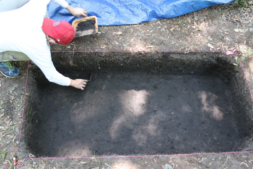
FSU Archaeological Field School student, Julian S., trowels the floor of an excavation unit in preparation for pictures. Notice the sunny spots in the unit. We use the blue tarp (top of picture) to block out the sun and “shade” the units to allow for better pictures.
Excavation units must be as smooth and level as possible to see the features in the soil. Features are changes in texture, composition, and or color of the soil and/or artifact density within the excavation unit. Many of the excavation units today revealed features of much lighter colored soil and of much darker colored soil than the normal soil found throughout the site. So why are features important? They are not tangible artifacts like ceramics or lithic, but they do tell us a wide array of information about the site and those who lived in it. Features tell us about human activities at the site, such as where a cooking fire or house wall once stood. Features can also depict where artifacts that no longer exist were once placed. The positioning of living, ceremonial, and working areas can be determined by the features that are found within the excavation units. Features map out what the layout of the site once was. Our goal is to identify features over the next few weeks, and during the last week document them via mapping and photography, and then excavate them taking 100% sample of the feature for further processing in the lab. We’ll post more on these features, what we are learning from them, and how we process them in the coming days. After today, we are off for a much needed rest over Memorial Day weekend!